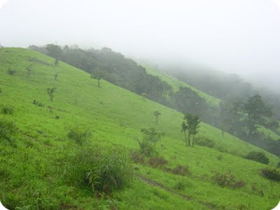
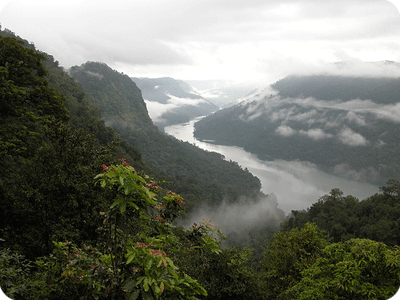
Kodachadri, 115 kilometers from Shimoga and 36 kilometers from Hosanagara in State of Karnataka is a picturesque hill located such that it overlooks the vast Western Ghats. Reputed for its splendid sunrises and sunsets. The peak of Kodachadri (at a height of 1343 meters above sea level) may be reached after a five-hour trek. On the western part, the hill descends almost steeply for about 1220 meters until it joins the forest of Udupi district. It over looks Arabian Sea also.
Road Route-
Private vehicles (read as Cars) cannot go till the top of the mountain. Only local jeeps are allowed to ply to the top of the mountain. From shimoga , one can hire a taxi to cover the distance of 105 kms to Sampagatte (foothills of the Kodachadri mountains).

Train Route-
The best way is to take a train , preferably a night train (Shimoga Express), which leaves Bangalore around 11.30 PM and reaches Shimoga at 5.30AM.
Air
Shimoga is the closest railway station while Mangalore happens to be the nearest airport.
Kodachadri, in itself does not have good staying options. There is one Inspection bungalow of the PWD, which might not suit all. Kollur (35kms from the foothill), offers decent staying options. One other option that we discovered this time around was ‘Simha Farms’. This place is 5 kms from Sampagatte, a farm spread over 12 acres. This is run by Adithya and his wife Anusha. In the midst of all the greenery, are 2 cottages that can accomodate 3 people each.

The historical iron pillars at Mehrauli, Delhi, and at Dhar, in Madhya Pradesh, have attracted the attention of scientists for over a century. However, a third iron pillar located in Adi-Mookambika temple at Kodachadri village in a remote forest area of the Western Ghats in Karnataka has not received much scientific attention so far, partly because the concerned village is difficult to reach and partly because the pillar itself is not as massive and imposing as the Delhi and Dhar monuments.
The well known temple town of Kollur is 12 kilometers away. These hills (4411 ft) comprise one of the biggest forest zones in Karnataka and a section of this region constitutes the Mookambika Nature Reserve. Kollur is the perfect base from which to explore the hills. The Mookambika Nature Camp is situated 4 kilometers to the south of Kollur. The Linganmakki Dam, within close proximity of Kodachadri, is also a must see for visitors to this place. The best time to visit the hill station of Kodachadri at Karnataka is in the period within October to May.
Road Route-
Private vehicles (read as Cars) cannot go till the top of the mountain. Only local jeeps are allowed to ply to the top of the mountain. From shimoga , one can hire a taxi to cover the distance of 105 kms to Sampagatte (foothills of the Kodachadri mountains).

Train Route-
The best way is to take a train , preferably a night train (Shimoga Express), which leaves Bangalore around 11.30 PM and reaches Shimoga at 5.30AM.
Air
Shimoga is the closest railway station while Mangalore happens to be the nearest airport.
Kodachadri, in itself does not have good staying options. There is one Inspection bungalow of the PWD, which might not suit all. Kollur (35kms from the foothill), offers decent staying options. One other option that we discovered this time around was ‘Simha Farms’. This place is 5 kms from Sampagatte, a farm spread over 12 acres. This is run by Adithya and his wife Anusha. In the midst of all the greenery, are 2 cottages that can accomodate 3 people each.

The historical iron pillars at Mehrauli, Delhi, and at Dhar, in Madhya Pradesh, have attracted the attention of scientists for over a century. However, a third iron pillar located in Adi-Mookambika temple at Kodachadri village in a remote forest area of the Western Ghats in Karnataka has not received much scientific attention so far, partly because the concerned village is difficult to reach and partly because the pillar itself is not as massive and imposing as the Delhi and Dhar monuments.
The well known temple town of Kollur is 12 kilometers away. These hills (4411 ft) comprise one of the biggest forest zones in Karnataka and a section of this region constitutes the Mookambika Nature Reserve. Kollur is the perfect base from which to explore the hills. The Mookambika Nature Camp is situated 4 kilometers to the south of Kollur. The Linganmakki Dam, within close proximity of Kodachadri, is also a must see for visitors to this place. The best time to visit the hill station of Kodachadri at Karnataka is in the period within October to May.


